


Flooding minimal despite extreme late-winter weather
Mary Auld
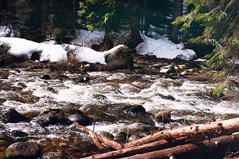
Streams aren't expected to cause major flooding this spring in Lake County because mountain snowpack is below average.
Hey savvy news reader! Thanks for choosing local.
You are now reading
1 of 3 free articles.
LAKE COUNTY – Though the winter may have seemed never-ending, lower than average overall snowfall for the winter means there’s less risk of flooding as snow melts this spring.
“We are seeing signs that spring runoff season has begun,” said Casey Ryan, hydrologist for the Confederated Salish and Kootenai Tribes. According to Ryan, waterway discharge has spiked, indicating that snow is melting. The spike in runoff came about three weeks later than it did at this time last year.
According to Lake County Commissioner Dave Stipe, the only flooding, so far, has been small streams of water across roads. These can be attributed to culverts that are full of ice, preventing water from passing through. Stipe said the issue would abate as ice buildup in culverts melts.
It may come as a surprise that the area is experiencing less flooding than last year because snow banks stuck around later than usual this spring.
While the winter ended with significant snow build up, Stipe said that doesn’t correlate to a greater probability of flooding. “Sometimes having snow later stops you from having as much flooding because it’s melting off slowly,” Stipe said.
Spring developed slowly
Snow stuck around because temperatures remained cold well into March this year. Missoula didn’t see a 50-degree day until March 20. That’s more than a month later than usual. On average, the area reaches 50 degrees by Feb. 17.
“It’s been pretty unusual weather,” Ryan said.
The Mission Valley saw record snowfall this February. According to Ryan, the Bison Creek site east of Polson recorded the largest February water accumulation in more than 28 years with double the amount of moisture accumulation.
The state received more snow than average in the late winter months.
“We have a very healthy valley snowpack,” Ryan said. “But the story’s not quite the same in the mountains.” Snowpack is currently at just 83 percent of normal in the mountains.
Less snow in the mountains means there will be less flooding. Last year, when the county saw significant flooding, snowpack in the mountains was 140 to 150 percent of average.
Minimal road, property damage predicted
In general, Stipe predicts, the spring won’t see much damage to county infrastructure. He expects minimal frost damage to roads as they thaw. Last year’s uncommonly high winter moisture caused significant damage to roads and bridges in the area. Road weight limits started last week to reduce damage to the roads from heavy loads.
Stipe added that Lake County is less susceptible to property damage from flooding because homes are built further from waterways than in other counties. Irrigation reservoirs catch excess runoff before it can cause damage.
If people do see water on the road, caution is advised. Even a small amount of water on a road can create dangerous driving conditions. According to Ryan, just 12 inches of water can carry a small car. Instead of trying to drive through water flowing across a road, “it’s better to turn around or wait it out,” Ryan said.
Small chance of flooding remains
So far, it looks like flooding won’t cause significant damage; however, Stipe said: “It can still happen. It just depends on the weather.” According to Stipe a big weather event, like warm Chinook winds or significant rainfall could cause snow and ice to melt quickly and trigger flooding. Ryan said ice jams in rivers and streams could also cause floods.
Moving into late spring and early summer, Ryan said long-range forecasts predict temperatures mildly above average in the next three months. The forecast doesn’t show strong suggestions of either above or below average precipitation.
Stream flow is forecasted to be below average for northwest Montana, due to lower than average snowpack in the mountains.
Flooding across the state
Other parts of the state aren’t faring as well as Lake County this flooding season. The Bighorn River in southeast Montana had an ice jam, which flooded parts of I-90. Sections of the road from Hardin were closed as a result. According to a press release, Senator Jon Tester is asking for “a swift and effective response” from federal disaster relief agencies to mitigate flooding in the southeast of the state.