


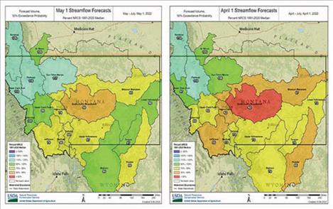
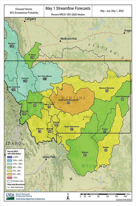
Montana streamflow forecasts increase after April precipitation adds to snowpack
Hey savvy news reader! Thanks for choosing local.
You are now reading
1 of 3 free articles.
News from USDA
BOZEMAN — After nearly three months of waiting for typical winter weather, cool temperatures and precipitation finally arrived during April in Montana. Prior to April, northwest Montana had been the largest recipient of precipitation this water year. “Weather patterns shifted last month, and April precipitation was slightly below normal in northwest Montana but well above normal in southcentral and southeast Montana,” said USDA Natural Resources Conservation Service (NRCS) Hydrologist Eric Larson. The Missouri headwaters and mainstem received near normal precipitation during April. The cool weather and precipitation resulted in snowpack percentage increases in all of Montana’s major river basins from April 1. The only exception is the Milk River basin which doesn’t have any snow remaining at the one SNOTEL site in the Bears Paw Mountains near Havre.