


Grant to improve mapping for growth planning
Shay Farmer
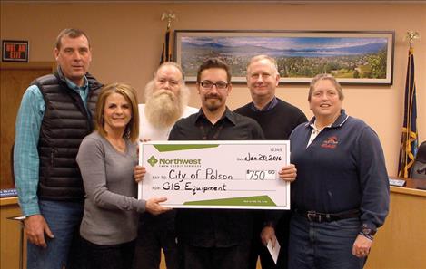
Celebrating the grant to support GIS mapping are, from left, Tim Lake of Lake Seed Inc; Joey Hennes, Relationship Manager/VP of Northwest Farm Credit Services of the Missoula branch; Tony Porrazzo, Polson Water and Sewer Superintendent; Forrest Niemeyer, Water and Sewer GIS Technician; Polson City Manager Mark Shrives; and Karen Sargeant, Polson parks director.
Hey savvy news reader! Thanks for choosing local.
You are now reading
1 of 3 free articles.
POLSON — It all began in 2010 with a grant written to inventory all the trees within Polson city limits. This inventory began the city’s exploration into the Geographic Information System. This helps create concise layering of the city’s utilities from various city departments into one master map. The city was awarded a $750 grant recently from Northwest Farm Credit Services to assist with the purchase of supplies for the plotter and scanner that will improve the accuracy of the maps created.
The Water and Sewer Department and Parks Department have worked closely in using the GIS equipment to map the growth of the town. Older, non-digital maps can be scanned in that include locations of water and sewer line additions, other technical features, and trees. The information can then be “layered” into a map. Local, county, and state official’s work together to create national GIS systems.
“It’s amazing what you can do with this stuff,” Karen Sargeant, Polson parks director said.
Forrest Niemeyer, the GIS technician for the city’s Water and Sewer Department, said that once all the below ground and above ground resources are mapped, one can better find the assets of the town. This can aid in future planning for development. More accurate and newer data is able to be kept because the maps created today are made from GPS coordinates rather than human measurements. He called the capability of the technology “powerful.” Seemingly unrelated features of a city can also be compiled. For example, GIS can map natural resources such as watersheds.
Niemeyer is currently attending Salish Kootenai College’s GIS Certification Program so he can better aid the town of Polson in using their equipment.
“(The college) is doing progressive work to map our natural resources,” Niemeyer said.
Tim Lake, owner of Lake Seed Inc., helped the city in obtaining the grant from Northwest Farm Credit Services. A Farm Credit customer must obtain a letter of support. The funding source “looks for collaborative approaches to addressing challenges and opportunities in rural communities,” according to NFCS literature.