


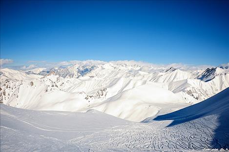
Snowpack more than doubles in western Montana during January
Bigstock photo
snow
Hey savvy news reader! Thanks for choosing local.
You are now reading
1 of 3 free articles.
News from the Natural Resources Conservation Service
BOZEMAN – Abundant moisture spilled into the Treasure State from the Pacific during January, boosting snowpack in all river basins to near or above normal for Feb. 1. In some locations, the amount of water added to the snowpack was record setting. Between Dec. 30 and Feb. 1, snowpack telemetry sites west of the Continental Divide received up to 18 inches of snow water equivalent, roughly proportionate to 100 to 150-plus inches of snowfall. Five SNOTEL sites would go on to set new records for monthly totals and four SNOTEL sites reported their second highest on record.
“November and December were particularly dry, resulting in snowpack totals on Jan. 1 that were well below normal in the river basins west of the Divide. The near continuous snowfall and moisture during January was extraordinary, and it helped the river basins to bounce back to near or above normal for snowpack on Feb. 1. It was quite the month,” said Lucas Zukiewicz, USDA Natural Resources Conservation Service water supply specialist for Montana.
“Although snowfall wasn’t record-setting in river basins east of the Divide, it was near to above normal for the month, helping the snowpack to improve in most areas,” said Zukiewicz. Southwest Montana experienced some of the most dramatic increases with the Jefferson and Madison River basins improving from below normal to near normal for snowpack on Feb. 1. The West Yellowstone area, where mountain snowpack feeds the reservoirs supplying water to the Madison River, was well below normal on Jan. 1. “The mountains above Hebgen Lake received significant snowfall this month, helping to not only improve conditions for winter recreation, but water supply prospects this spring and summer,” said Zukiewicz.
South-central mountain ranges experienced slight increases in snowpack percentages during the month, while north central mountain ranges had a slight decrease from well above normal. “This region had been benefitting from early October snowpack which remained on the ground, keeping snowpack totals near to slightly above normal on Jan. 1, and it remains there at this time,” according to Zukiewicz.
At this point in the winter, around 60 percent to 70 percent of the seasonal peak snowpack has typically accumulated in river basins west of the Divide, while 55 percent to 65 percent of the seasonal peak snowpack has accumulated east of the Divide. “The coming months will tell us just how full the mountain snowpack “reservoir” is before spring runoff, and early February looks favorable for continued snowfall. Hopefully this wet pattern persists, and we can put some more water in the bank,” said Zukiewicz.
Monthly water supply outlook reports can be found at the website after the fifth business day of the month: https://www.nrcs.usda.gov/wps/portal/nrcs/mt/snow/.